Online services for laying out bicycle routes. How to plan a cycling route? Important elements of the plan
Total length – 29 km
Picturesque embankments are an excellent option for a pleasant bike ride around Moscow. The route begins from Nagatinskaya embankment. We drive to the Novospassky Bridge, where we cross to the other side. We continue the trip to the Ustinsky Bridge. There you will have to get off the bike for a while and go down the stairs. No more obstacles will appear until the end of the journey. But there will be excellent views of the Kremlin, the Cathedral of Christ the Savior and the Luzhniki Stadium. Then we fly along the Novodevichy, Savvinskaya, Smolenskaya and Krasnopresnenskaya embankments. We end the trip in the pleasant Krasnaya Presnya park, or you can get to Moscow City and look at the skyscrapers.
Cycling route “Museon–Victory Park”
The length of the route is 16 km.
An equipped dedicated cycling route starts from Muzeon Park. Then we go to the park named after. Gorky, where you can stay for a while, go on attractions or just ride along the park alleys. The path continues to the Vorobyovy Gory, from where excellent views open up. We pedal another couple of kilometers and get to Victory Park, where the bike path ends.

"VDNH-Ostankino"
The length of the route is 12.5 km.
VDNH is one of the most interesting places in Moscow. Here you can drive through the pavilions, watch exhibitions, or go to some festival. The cycling route passes through the Botanical Garden with an area of 540 hectares, then you can admire the original rock garden, ride through Ostankino Park and get to the Ostankino TV Tower. We end our trip near the Ostankino estate, where you can relax and sit by the pond.

Bicycle path in Izmailovsky Park
You can have a great time riding around Izmailovsky Park. There is an equipped bicycle path with signs that will prevent you from getting lost. We start the route from the sports ground near the College of Industry, Hospitality and Management No. 23. On the way, we stop at Terletsky Park, admiring the beauty of the Izmailovo estate and the Cathedral of the Intercession of the Blessed Virgin Mary. One of the iconic places on the route is the Izmailovo Kremlin. Here you can linger a little and go on a detailed tour. You can finish your journey by reaching the desired metro station: Izmailovskaya, Partizanskaya or Shosse Entuziastov.

Cycle route “Moscow-City–Crimean Bridge”
Total length – only 12 km.
A simple and interesting route around Moscow is suitable even for beginners. The path begins from Moscow City, from the Taras Shevchenko embankment. We will drive all the way along the right bank of the river, repeating its bends. We drive along Vorobyovy Gory and Andreevskaya Embankment to Neskuchny Garden. You can stop here and relax in the shade of the trees, or drive a little further, reaching Gorky Park. There is definitely a lot of entertainment and opportunities for a wonderful holiday here. The finishing point of the route is the Crimean Bridge.

South East Cycling Route
This route is loved by professionals. There are many slopes and climbs along the way, so you won’t get bored. We start moving from the Maryino metro station. We drive through the city streets and turn towards Borisovsky Ponds. Then you can slowly drive along picturesque bodies of water and get to the Kapotnya district.

Park named after Gorky
Riding around the park is a pleasure. Even if you don’t have your own bike, you can rent one. The route passes through numerous alleys of the park. Ideal for a leisurely drive on a pleasant summer day.

Central route
The length of the route is 9 km.
You can explore many Moscow sights while riding a bicycle on this route. The bike path starts on Rozhdestvensky Boulevard. From here we go towards Pushkinsky Square, drive past the Moscow Government building, stop at New Arbat and go to the Patriarch's Ponds. Here we can take a short break and move on to the M. Bulgakov Museum. Next to us are the Aquarium Garden, the Satire Theater, and the Theatre. Mossovet and Sadovo-Triumphal Square. We end the journey in the Hermitage Garden.
The route is not difficult, but it is not suitable for everyone, since most of the way you will have to drive along a busy road next to traffic.

"Ustinsky Square-Park Sokolniki"
The length of the route is 7 km.
We start from the Bolshoy Ustinsky Bridge, along which we cross the river and end up in Ustinsky Square. From here we drive along Yauzsky Boulevard, then along Pokrovsky, and then along Chistoprudny. We drive along the Boulevard Ring and head to the Turgenevskaya metro station. We turn onto Academician Sakharov Avenue and head towards the Komsomolskaya metro station. We continue moving along Krasnoprudnaya Street and further along Rusakovskaya. We get to the Sokolniki metro station and finish our journey in the park.
By the way, in Sokolniki Park itself there is also a bicycle path. Here you can leisurely stroll along the alleys and enjoy the surrounding greenery. And if you don’t have any strength left, then just stop for a picnic.

Cycling route through Bitsevsky Park
The length of the route is 7.5 km.
If you like to ride in nature, then the best place in noisy Moscow is Bitsevsky Park. This vast forest area is perfect for a pleasant drive among trees, fragrant herbs and beautiful scenery. Please note that there is no special bike path in the forest, so unprepared bikers should be especially careful. And in any case, it is better not to accelerate too much.
Here you can build your own route and choose any path you like. The map suggests one of the possible options with a length of 7.5 km.

Routes are a very important matter. The joy of cycling depends on where and how we go. Previously, routes were planned on a paper map in pencil, with a curvimeter and an officer's ruler. Now dozens of applications, services and mobile solutions are coming to our aid, from which there is no escape.
The cycling world is quite small, so there are few specialized services and programs. Most of the serious developments are universal - like the products of the world giants Google, Yandex and Baidu or Navitel maps for motorists.
However, different offers are convenient in different ways, to do this we will review several services, identify their pros and cons, and note whether a cyclist should use them. First, let's look at what a bike route is and how it is used, and then we'll look at the different types of services.
Cycling routes
To begin with, why are we planning a route? Several directions:
- Cycling tourism– when the path is an end in itself, you should overcome it and enjoy both the load and the beauty. This is where experience comes first, not apps. Human participation in planning is very important.
- Walks– here, on the contrary, the route should be planned automatically, indicating the points you want to visit. The service will automatically build the optimal path with minimal effort.
- Movement– the requirements are twofold: on the one hand, the cyclist most likely knows the area better than any service, and on the other hand, perhaps the destination is new and automatic routing will be needed.
In addition to planning a cycling route, there is also a part of gaining experience. Previously, again, lovers of cycling tourism exchanged atlases with interesting maps marked, now the easiest way to do this is with the help of online services.
The second most interesting task is recording GPS tracks for subsequent analysis of your movement. We are talking, rather, about athletes and tourists, because it is important for them to know which elements of the path were simple and which had problems. Nobody canceled the competitive part either. Many sections are measured, and real self-organized competitions take place along them to see who can overcome the section the fastest.
Online maps
The most popular and accessible type of service, perhaps for most, is online maps. There used to be Google Earth and a few older alternatives that weren't widely adopted. Currently, cards from world giants have become a part of our lives, and here's why:
- always accessible map of any area;
- up-to-date information on infrastructure and travel options;
- quick measurements and changes in your own maps;
- discussion and sending of the drawn route.
Yes, the main thing in online maps is “drawing”. Those. services are becoming a replacement for the paper map on which we draw our route using our own heads. It is worth noting that many services are developing towards sociality and navigation, but are lagging behind their specialized competitors. However, most of the “competitors” end up using OSM, Google or Yandex as the basis for drawing maps.
http://www.openstreetmap.org/
The first service worth talking about is OpenStreetMap. Slightly overloaded cards are the quintessence of freedom in the modern world. All maps of this resource are compiled and verified by users. Thousands of people around the world mark objects, their changes and properties, and monitor the relevance of information.

For cyclists, OSM will be useful in the sense that these maps reflect not only roads and residential areas, but also many attractions, and, most importantly, bike paths and infrastructure for cyclists. There are quite a lot of them among activists, which is why maps are so useful for us.
https://www.google.ru/maps
The popularity of Google Earth is gradually declining, but maps from Google are becoming more and more popular. Satellite images, databases of establishments, fast work and wide social opportunities - everything attracts cyclists to the global corporation. Google Maps makes it easy to draw your route, and even easier to store and share it.

An additional, and very significant, advantage is the ability to lay out a route, both pedestrian and road, between any points. A new feature was announced not long ago. Now Google Maps can plot routes for cyclists, taking into account awkward turns and bike paths.
However, navigation from Google is still inferior to specialized services and even to its Russian competitor, Yandex.
http://maps.yandex.ru/
“Our answer to Google” - Yandex.Maps is actually even slightly superior to the global corporation. And maps from Yandex are good for two reasons:
- Completeness of data about Russia and the CIS - any other services, including Ovi and the Chinese, not to mention Google, have little knowledge of Russian villages and country roads. They are simply not on the maps. Yandex meticulously demonstrates all the primers and even paths, second only to OSM in completeness.
- Really good navigation. Although it is automotive and does not take into account elevation changes, the logic that builds navigation routes in Yandex is excellently developed.

In addition, Yandex maps can be used as a source for Yandex.Navigator with voice prompts along the way. At Google, you will have to use additional applications from third-party developers for this.
GPS tracks
A big greeting from professional athletes and car enthusiasts – these are GPS tracks and services for storing them. Navigation used in cars is a fairly old product, and already twenty years ago, recordings of trips - so-called GPS tracks - were in use.
Nowadays, services have moved far beyond simply storing information from a GPS navigator. They offer a whole range of services:
- building statistics based on the trip record;
- planning a trip (i.e. planning a route, which is what we need);
- exchange and cataloging of different routes.
As you can see, in addition to the mapping function, track services offer us a lot of interesting things, which is why they are especially interesting. Since we are considering building paths for cyclists, we will consider the corresponding services.
http://www.bikemap.net
Perhaps the largest site for storing and discussing various cyclist tracks. A huge number of downloads in Europe and America, good coverage in Russia and a large number of Russian-speaking users. Part of an association of several track sites including cycling, running, moped and even roller skating enthusiasts.

The route planning is very convenient for the cyclist. An elevation graph is automatically generated, from which you can determine the upcoming load.
There are no problems with the social component either - all routes can be public and discussed. The catalog itself is convenient and allows you to choose a track according to the desired parameters - riding style, total duration of the journey.
To record and follow the route, there is an application of the same name - an almost full-fledged navigator. Perhaps, from the track storage section, Bikemap.Net is the leader today.
http://www.opencyclemap.org
A spinoff from OpenStreetMap uses the OSM map, supplemented with layers of real GPS tracks of cyclists. A beautiful map of Europe gives us an idea of where this service is especially popular. Unfortunately, there are practically no fans of it in Russia, despite the very rich functionality and the ability to lay out routes taking into account the elevation map and bicycle paths.

It should be noted that the system has a huge number of intercity tracks, i.e. it is used for very practical purposes - to learn how to most effectively travel between cities by bicycle. Actually, for an interesting trip on two wheels across Europe, you cannot find a better service.
http://www.gpsies.com
A very old and reliable track storage service from Germany. A huge database of covered tracks throughout Russia may appeal to many “old school” cyclist tourists, but these days a weak native application, outdated design and unclear operating logic scare off more users than they attract.

MyTracks
If GPSies is a service without an app, then MyTracks is a great app without an intrusive service. We record and analyze routes. Of course, we are not talking about any route construction.
Sports trackers
For sports trackers, maps are far from the most important thing. But, realizing that the majority of health-conscious users will cycle, run or hike in the mountains, application manufacturers include a route component in their composition. Typically this is a contract with Google or OSM, and further use of functionality similar to GPS track storage.
Unfortunately, a dedicated tracker with routes for cyclists has not yet been made, and the tracks are laid according to automobile or pedestrian rules, occasionally with priority for bicycle paths, but nothing more.
There are a huge number of sports applications. We will analyze only those of them that the author of this article had a chance to use.
https://www.endomondo.com/
One of the most serious and comprehensive services for sports. A huge amount of input data, interesting calculations and statistics. A universal application and universal web service allows you to conveniently use one application for all types of activities, and a strong social component allows you to attract friends.

The disadvantages include the heaviness of the application - with each update, the requirements for hardware increase (especially for available RAM), and the rapid consumption of battery life.
The application lays out routes quickly and well, navigation with a voice assistant works perfectly, but the route is laid out by a car.
http://www.mapmyride.com/
Similar to Endomondo, but with separate applications for each activity. They are not particularly different, but they are a little more convenient to use on smartphones. The application, just like its competitor, loves expensive hardware and works using its full capabilities. Navigation features are quite standard.

I'm pleased with the service. It not only shows the most detailed analytics, but also allows you to plan a route taking into account altitudes, other routes, the results of the cyclist and other cyclists on different sections. This service is an excellent record and route manager with good social capabilities.
Perhaps, for the demanding cyclist, MapMyRide is the best choice.
https://www.strava.com/
Strava doesn't seem to be the market leader, but the app is very, very good. Regular Google navigation, a simple interface and trouble-free operation even on weak smartphones – that’s Strava’s specialty. A decent tracker without unnecessary features, which is popular with hundreds of thousands of users.

The latest releases from Strava are adding a social component to discussing routes and competing over segments, which is good news.
Conclusion
Modern driving directions apps have come out of the automotive world and are still as closely related to it as possible. In the cycling part, the most interesting developments are in terms of sports trackers. The bottom line of this review is that if you're an old-school cyclist and want a good map without too much interactivity, OpenStreetMap, Bikemap and Google are your best bets. Bikemap and OpenCycleMap will help modern professionals, while simple amateurs are best off using one of the sports applications.
The routing capabilities in all of these programs are very similar and quite old. This is a layout on a map taking into account roads. The emerging improvements in connection with heights and bike paths are still more of a research and development project than effectively used functions. The trend in recent years is sociality, competitions and discussions of routes. These new products are worth using, although they are very indirectly related to effective planning.
Imagine it's summer, the sun is shining, you're on vacation, and you and your friends are avid cyclists. The thought arises of a cycling trip somewhere far away. In this article I will talk about how OpenStreetMap technologies and some other services make life easier in this situation, solve planning problems and allow you to quickly and easily share your impressions. The emphasis is on online, I mention resources:
Trip planning
So, at some cycling forum or from friends you learn that place X is simply super, every self-respecting cyclist must go there and it’s generally unclear why you haven’t been there yet. If X is completely unfamiliar to you, then questions arise:Where is X?
The official website OpenStreetMap, despite its spartan asceticism, allows you to search for settlements, places, etc. “out of the box.” Nominatim, which is “tailored” specifically for search, will also be useful.What's the best way to get there?
The first place you should look if you do not live in Russia is OpenCycleMap. This is a special map for cyclists with cycling routes. The routes, I would say, are global and are not designed for local easy 8-hour walks.In other cases, you will have to plan the route yourself. As a rule, the automatically laid route is not ideal and requires manual “finishing”. So I recommend the combination of OpenRouteService and ShowYourJourney, they both use OpenStreetMap data.
OpenRouteService
An excellent German site, it opens in German by default, but it has the treasured English flag at the top right. Click on the Start line, then on the departure point on the map, then on the End line, then on the destination on the map, and finally on the Calculate button. The result will appear quite quickly, incl. total distance and instructions such as “in 200 meters turn right.” You can find routes for cars, pedestrians and cyclists. For the first and last options, unique options are available, the meaning of which is clear from the name, but just in case, it has been empirically tested many times. For a car, it is possible to choose between the fastest and the shortest path, because the shortest one can be winding or with a bunch of traffic lights and other troubles. For pedestrians, the shortest path is sought, using paths, paths, sidewalks, etc., carefully mapped by OpenStreetMap cartographers.For cyclists, the settings are especially rich: shortest path/ shortest track, the safest way / safest track(avoid big roads), for road bike/ racer(on the contrary, try to build a route along highways), for mountain biking/ mountain bike(the mode is similar to the safest one, apparently, tortuosity is added). In addition to the options listed, the algorithm can be further customized (more options), in particular, manually enabling the option to avoid roads and tram tracks, as well as highlighting polygons on the map through which you cannot drive/pass. The result can be exported to a link with parameters inside or to standard GPX. In general, German developers deserve respect, especially since an impressive list of scientific publications is available on OpenRouteService (in the INFO&CONTACT section).
ShowYourJourney
The longer the route from OpenRouteService, the greater the likelihood that somewhere it is not laid very well, and a person could have done it better. ShowYourJourney allows you to download a GPX route and edit it manually. However, you can create a route from scratch. The work with the track has been successfully implemented - each link can always be divided in half in the middle. To get started, click on “start a route” in the bottom right. Of course, the result can be exported again to GPX.The GPS Visualizer Freehand Drawing Utility service is similar to ShowYourJourney, but you cannot import data there.
 |
| Interface Show your journey. |
Where can I get maps for my navigator?
Now you want to save the map with the route in your navigator (if you have one). You can download OpenStreetMap maps on the wiki of the Maps of Russia project, and I think there will be no problems with loading GPX into the navigator.How to prepare a printed version of the map?
Navigators can be unreliable (for example, the battery runs out quickly), and their screen is small due to portability. It is good practice to take a map printed on paper with you. Although the official OpenStreetMap website allows you to print, your output will be, to put it mildly, a bit small. For high quality printing purposes there is MapOSMatic. Just set the rectangle with the mouse, holding down Control, and go ahead. The service supports export to SVG and raster, conveniently divides the map into squares and creates an index. How to automate card printing with our route using OpenStreetMap is an open question. I think Maperitive can handle this offline. Also, nothing prevents you from using GPSVisualizer.
|
| Web interface to GPSBabel from GPS Visualizer |


How to optimize a track?
It's no secret that the track recording function of navigators is implemented in the same way - a mindless machine simply remembers your position at a given time interval. As a result, tracks take up megabytes after 12 hours of recording, and the services working with them are extremely strained. The information in the “raw” tracks is redundant: if you drove in a straight line all the time, the internal points can be thrown out with a clear conscience. Also, in parking lots, the GPS “sausages” and “Brownian motion” occurs around the true position.To solve this problem there is CourseMapper. Unfortunately, it is built on the basis of Google Maps and you cannot create an OpenStreetMap background in it, but it is capable of downloading a track directly from Garmin devices, and, of course, it is compatible with GPX. In its settings you can select the minimum accuracy in meters and the version of the algorithm (speed versus quality). The service can be thoughtful when dealing with large amounts of data. If your track is very large, then you can either cut it into pieces and then glue optimized ones together, or use offline solutions. Optimization greatly reduces the track size, depending on settings and data, up to 1000 times.
 |
| Commander-like CourseMapper. |
What is the coolest and most beautiful way to show the track?
We are talking about “clean” visualization, better quality than that of ShowYourJourney. If you are too lazy to reinvent the wheel yourself, my advice is to use GPS Visualizer. This is just a very sophisticated and free visualization service, powerful and flexible, with its own community and wiki. I’ll just list the especially “tasty” features:- Simultaneous display of several tracks at once. It is convenient if your travel companion meets you halfway and your tracks are different.
- Import from GPX.
- Export to raster and vector. Export an interactive map to HTML (using Google Maps).
- In the interactive map, you can customize the default background, be it OpenStreetMap or Google satellite imagery.
Cycling routes are laid out for different purposes.
– walk – where the main task is to enjoy the walk, visiting certain places with minimal effort
— bicycle tourism – where the path is the end in itself
- movement - from A to point B, priority destination.
If in the old days bicycle routes were planned on a paper map in pencil, with an officer’s ruler and curvimeter, today dozens of services, applications and mobile solutions are available. And each application has its pros and cons.
Perhaps the most popular and accessible type of service today is online maps:
OpenStreetMap
is a non-profit web mapping project to create a detailed, free, and free geographic map of the world. All maps of this resource are compiled and verified by Internet users. This is how people from all over the world mark objects and monitor the relevance of information.
The maps display points of interest, which can be very important for cycling.
Among the minuses, it should be noted that the maps are overloaded and the lack of additional functions.
Google Maps
— The service is a map and satellite images of planet Earth.
Has the ability to create a route and ample social opportunities. But for the territory of Russia, Google is still inferior to specialized services and even Russian Yandex.
Yandex maps
— search and information mapping service of Yandex. For Russia, Ukraine, Belarus and Kazakhstan, only the company’s own maps are used, which are updated monthly.
So Yandex, compared to other services, scrupulously demonstrates all the primers and even paths of Russia and the CIS. Usability and the logic that builds navigation routes in Yandex are excellently developed.
Bikemap
is the most famous site among cyclists.
It contains information on more than 2 million cycling routes around the world. Popular and little-known bike paths, their detailed descriptions, amateur routes, etc. - all this is marked on the maps and is available online. You can not only view ready-made routes, but also create your own and share them with other users of the service!
On the Bikemap main page, you must enter the name of the city in the search box.
On the interactive map, all available routes (official and amateur) are marked with icons, and to the left of it are the most interesting nearby ones based on user ratings.
The map can be moved, scaled, and changed viewing mode.
When you click on the icon, a page with a detailed description of the route will open, where you can:
- Familiarize yourself with the route in detail.
- View the height graph, which can be used to determine the upcoming load.
- Find out which user created the route
- Save the route to your bookmarks or mark it as completed
- Add a comment
- Send link to social networks
- Download the route in KML or GPX format
Example route on Bikemap:
From the track storage section Bikemap is the leader today.
Open Cycle Map
This is a sister project of Open Street Map. Serves to designate bicycle paths, bicycle parking, various amenities and other things related to traveling on a two-wheeled iron horse.
The colorful map of Europe makes it clear where this service is really popular. Alas, in Russia and the CIS the situation is strictly the opposite.
We conclude: for a fun and interesting trip around Europe by bicycle, this is the best service.
GPSies
With GPSies you can view and download tracks recorded using a GPS device. Tracks can be downloaded to your personal GPS device.
A very old and reliable track storage service from Germany. A huge database of covered tracks throughout Russia may appeal to many “old school” cyclist tourists, but these days a weak native application, outdated design and unclear operating logic scare off more users than they attract.
— recording GPS routes and more.
MyTracks – A great Android app is MyTracks, available for free on the Android Market. However, we are not talking about any route construction.
Sports trackers
Endomondo
Endomondo is a free app and website. One of the old trackers. Today there are about 20 million users of the program on all major platforms.
A huge amount of input data, interesting calculations and statistics (however, detailed statistics are available only in the paid version).
Another one of the old-timers of the market. The program appeared quite a long time ago and was immediately aimed at cyclists; later functions for training in other sports appeared.
This is the only application that allows you to analyze areas taking into account the relief.
Regular Google navigation, simple interface and trouble-free operation even on weak smartphones. A decent tracker without unnecessary features, which is popular with hundreds of thousands of users.
Search and create public transport routes that are optimal for you FROM your location to the desired street or house, as well as car, bicycle and walking routes for walking.
Choose transport:
Public transport By car Bicycle On foot
Show route on map
Route on the city map.
Are you asking where you can get or how to get to a certain street or house in Moscow? The answer is very simple, find your optimal route around the city using the trip planner on our website. Our service will find for you up to 3 options for travel around the city of Moscow FROM your address to your destination. On the map with routes, click the more details button (the start icon) and go to a detailed description of travel options. For all routes, travel time will be shown taking into account traffic jams, numbers of buses, minibuses and other public transport.
Popular routes:
- FROM: Moscow, river station - TO: Moscow, mega Khimki;
- FROM: Moscow region, Dolgoprudny, Likhachevskoe highway - TO: Moscow, international highway 28;
- FROM: Moscow, Mitino metro - TO: Moscow, metro 1905;
- FROM: Moscow region, Bogorodsky urban district, gardening partnership AZLK-3 - TO: Moscow, Avtozavodskaya metro station;
- FROM: Moscow, Kutuzovsky prospect 20 - TO: Moscow, Anino metro station;
Users of our site often ask, for example: “How to get from the bus station to the hospital?” and so on. We decided to make it easier for everyone to find the optimal route.
Driving along a pre-designed route is a way to eliminate problems that may arise in unfamiliar areas and overcome the desired section of the road as quickly as possible. Don’t miss out on details; check the map in advance for directions on the road and turns.
Using the trip planning service, you just need to enter the beginning and end of the route, then click the “Show route on the map” button and you will receive several route options. Choose the most suitable one and start moving. Four modes of route planning are possible - by public transport (including minibuses), by car, by bicycle or on foot.
 Is polyphosphate filter harmful to humans Sodium polyphosphate for washing machines
 Why does the pumping station often turn on: what to do
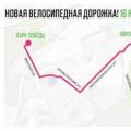 How to plan a cycling route?